Why I Use CoMaps to Find Hiking Areas Near Me
There are many hiking areas near me, which is nice because I like taking hikes out in nature preserves from time to time. Hiking is healthy, helps me feel more in touch with the rest of nature, and get's me away from the screen for a while. Here are some reasons I use CoMaps when hiking, and why you should try CoMaps on your next hiking adventure too!
CoMaps has the Most Accurate Hiking Trails
CoMaps gets its map data from the OpenStreetMap project. OpenStreetMap is well known for having many hiking trails, many more than on Google's or Apple's maps. This gives CoMaps a decisive advantage over other apps that don't rely on OSM map data. The data is so good that even paid apps like Komoot use OSM, but unlike those apps, CoMaps is gratis, or free as in beer.
CoMaps' Voice Instructions Make it a Better Hiking GPS Solution
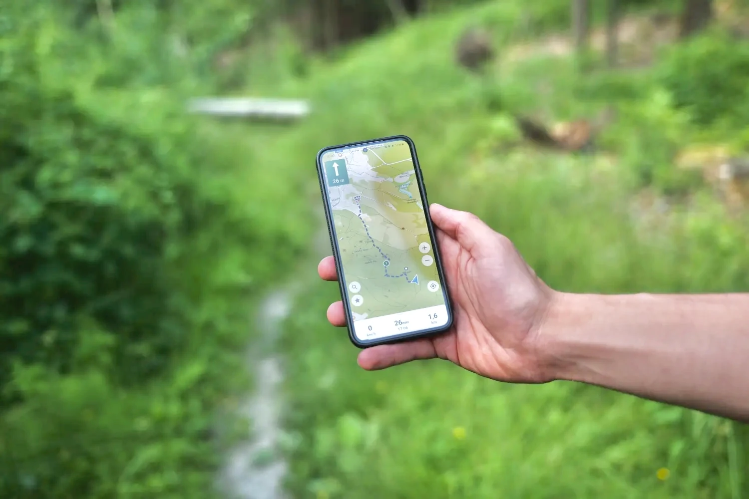
Imagine you're out hiking and you get lost in your surroundings. You might have been enjoying the trees or the grass, or feeling the burn in your legs. Maybe you were lost in conversation with a friend, or maybe the mosquitoes were keeping you busy. Whatever the reason, you forgot to check the map, and now you need to backtrack five minutes down the trail. Sound familiar?
CoMaps has a voice navigation feature that really helps on hikes. Instead of constantly stopping to check the map, or just ignoring it altogether, CoMaps will announce the turns you've plotted in your hiking route as you come upon them.
I like using the voice navigation feature so I don't need to look at the map. Once my hiking route is plotted in, I just need to follow the audible instructions and enjoy the hiking trail. It also saves my battery. CoMaps makes GPS based hiking less painful and more fun.
A Good Hiking App Saves Your Battery
Depending on how long you hike and how far in the wilderness you are, it can be extremely important to save your phone battery. CoMaps helps save your phone battery in two ways:
First, it works fully offline. Turn off your data, WiFi, and bluetooth to preserve precious battery life on long hikes. This is especially helpful if you have data hungry apps, as the more data your phone transmits, the more power it uses.
Second, with voice navigation turned on you can leave your screen off for longer periods of time. As you know, screen time is often the biggest contributor to battery drain. That's why GPS apps are known for draining your battery: they usually keep your screen on for most of the trip. I just choose the hiking trails near me I want to use in CoMaps, and then I don't need to keep the screen on after that.
Know More about Your Hiking Trail Ahead of Time
One feature I really like about CoMaps is that it tells you what to expect on your hike. When you plug in your route, it tells you how many miles you'll be hiking, gives a trail elevation profile, and an estimated time to finish the walk*.
This has really come in handy since my wife was diagnosed with arthritis in her knee. Now we choose a path that won't exceed a certain number of miles, round trip, and prefer hiking trails that feature hills and varying terrain.
* The accuracy of the hiking time estimate depends on the quality of the OSM data, and the calculation is still being improved.
Find What You Need on the Hiking Trail
Whether I'm just looking to find benches near me, or I want to hike with water near me, I can find that with CoMaps. When following a hiking path, I just hit the magnifying glass icon, search for water, or whatever else, press the "show on map" button, and results show up near me on the map.
I also use CoMaps to find new places to hike, such as nature preserves, parks, and paths. The easiest way to search for a place to hike is type "path" and hit the "show on map" button. If I want a park, I search "park", and zoom the map out a ways to see more parks around me.
Detours are Allowed
Sometimes I like to go a little bit further down the trail than I initially planed. Because CoMaps works 100% offline (not including map downloads, which of course requires Internet access), I don't need to worry about loosing cell service while out on a hike. Most apps like Google Maps require cell service to recalculate the route, but with CoMaps, all routing/rerouting happens locally on my phone. In fact I usually just leave my data off for most of my hikes, and CoMaps keeps me on track even if I detour.
Find Your Way Back
Another feature of the app is the ability to record your track. I haven't played around with this feature of CoMaps much yet, but if you're ever worried about finding your way back, like to your car, you can turn on this feature at the start of your hike. Then following your path is easy peasy. This would be ideal in cases where you aren't using a dedicated path, such as on a large beach or in a desert.
Offline Maps for Better Privacy
Google and Apple doesn't need to know when I decide to exercise, or not exercise! CoMaps is offline and doesn't track what I search for, what parks I view, which parks I favorite, or what trails I take. That means there's nothing for them to leak to hackers, and I am fully in control of my own data.
What About You?
Are you using CoMaps for hiking, or have a question that isn't answered by the FAQ? Join me and other users on Telegram, Matrix, or SimpleX!